How Climate Data Can Inform Better Urban Design: Report
By Chava Gourarie September 22, 2020 1:40 pm
reprints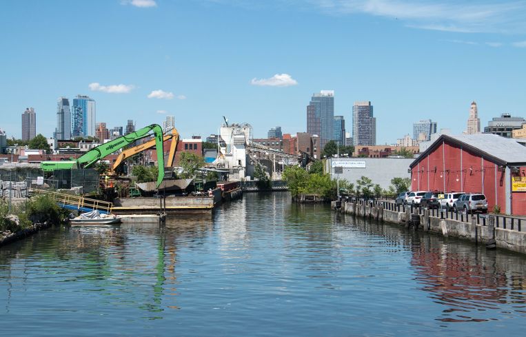
As the world gets hotter, summers in dense urban cities like New York could become deadly.
To prevent that, urban planners are rethinking how cities can better harness existing cooling systems, such as wind and waterways, to mitigate the effects of extreme heat, according to a new report from Urban Land Institute.
Using the Gowanus neighborhood in Brooklyn as a case study, the report used neighborhood-specific climate data to suggest urban design strategies that reduces the impacts of extreme heat, flooding and sea-level rise in the area.
The analysis was produced by a partnership between ULI New York, the New York Institute of Technology (NYIT) and the Urban Climate Change Research Network (UCCRN). It builds on previous efforts on behalf of NYIT graduate students, and many neighborhood groups, to design a future for Gowanus that they say meets the needs of the community and anticipates its future.
Gowanus has been in the midst of a rezoning process since 2016, which, if passed, would introduce a wave of residential and commercial development. Currently, Gowanus is surrounded by industrial and last-mile freight areas, and includes a federally designated Superfund site around the Gowanus Canal, which is in the midst of an ongoing cleanup.
The rezoning offers a chance to rethink how development and urban design can be implemented to mitigate, rather than exacerbate, the negative impacts of climate change, per the report.
“[The researchers] fused climate data and climate modeling specific to Gowanus to model the urban heat baseline in 2019, and in 2050, assuming the rezoning happens but it’s unmitigated,” Felix Ciampa, executive director of ULI New York, said.
The researchers found that without intervention, the maximum land surface temperature in Gowanus between June and August would rise from 89 degrees Fahrenheit currently to 96 degrees by 2050, while with best practices implemented, it would rise to 93 degrees.
Cities are hotter in general because of a built environment that absorbs sunlight and reflects it back as heat, lack of vegative cover, and less green space. In extreme cases that produces what researchers call heat islands, or extended areas of trapped heat with little opportunity for respite. Neighborhoods like Gowanus are particularly vulnerable to so-called heat islands, due to a shortage of green space—there’s just one park in the neighborhood—a heavily industrial built environment, and a lower-income population, which may not have access to air conditioning.
The strategies offered in the ULI New York-led report include developing a variety of different building types, using reflective building materials, expanding green space, and promoting micromobilityy (a.k.a. any individual private transport that isn’t a car). One strategy that might work in Gowanus is what’s called daylighting the water under the neighborhood, creating a vein that runs through it, offering a source of cooling, along with more open-air space and a public commons.
While some strategies, like daylighting water and building a series of parks, require long-term investment from the city, many others can be implemented more quickly by individual developers. These include using heat-reflective building materials, adding additional greenswards, and designing buildings that harness wind and light in more efficient ways, Ciampa said.