Hurricane Risk Up 10 to 15% Due to Higher Construction Costs
By Chava Gourarie June 2, 2023 9:58 am
reprints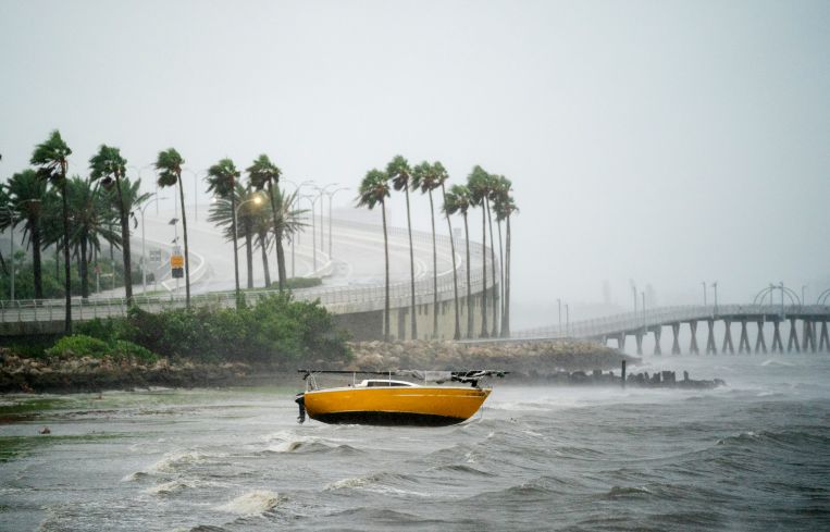
June marks the beginning of the annual Atlantic hurricane season, which is predicted to be an average season with between 12 and 17 named storms, according to the National Oceanic and Atmospheric Administration (NOAA).
That puts 32 million homes — both multifamily and single-family — in the danger zone should a hurricane make landfall along the Gulf of Mexico or East coast, with a combined reconstruction cost value of $11.5 trillion, according to a report from CoreLogic, which measures risk scores at the property level.
Southern and Gulf Coast cities are more likely to face a hurricane landfall, but Northeastern cities may have more to lose in economic terms, given their density, the prevalence of rental housing, and potential reconstruction costs — which have grown significantly in the last year across all markets.
“The number of homes, there’s not a significant change, but the total reconstruction costs increased on the order of 10 to 15 percent” relative to last year, said Jon Schneyer, senior catastrophe response manager at CoreLogic. “That’s accounting for increased labor and costs.”
In terms of multifamily units, just under 1 million homes are at risk nationwide from hurricane winds with a combined reconstruction cost value of $559.8 billion. Of these, 261,000 lie close enough to a coastline to also be at risk of flooding by storm surge, the damage from which could cost up to $132.3 billion to rebuild.
To reach these numbers — which are widely used by insurance companies — CoreLogic scores every property in regions known to suffer from hurricanes, from the Gulf Coast hot spots, particularly Florida, Louisiana and Texas, up through the mid-Atlantic, as well as cities along the Northeastern coast.
Hurricane Sandy in 2012 serves as the most recent example for the risks that face the Northeast.
“Just because an area doesn’t get hit by hurricanes frequently, the concentration puts a lot at risk,” Schneyer said, which is why the report doesn’t account for probability but for a worst-case scenario. “If we discounted another Sandy, it would be underselling the risk.”
Not surprisingly, the New York metro area, including New Jersey, has the most to lose: almost 500,000 multifamily units are at risk this year from hurricane wind with a potential cost of $278.1 billion, and roughly 111,000 are at risk of flooding from storm surge, with reconstruction cost values of $70 billion.
By contrast, the Miami metro area has 64,902 multifamily units at risk of hurricane wind damage, with a potential cost of $22.1 billion, and 31,428 units at risk of storm surge, at a cost of $9.9 billion. Boston has a similar number of units at risk of storm surge but at a higher cost of $14.8 billion, while its 82,780 homes at risk from wind carry triple the cost of Miami.
The difference in costs also reflects different building codes, as well as building styles, such as types of basements or roofs, and what materials are used, said Schneyer. In Miami, homes built after Hurricanes Andrew and Charlie have building codes designed to withstand higher wind speeds. Miami homes also tend to use more resistant materials such as concrete, as opposed to the wood-frame homes of the Northeast.
“If you have two homes built in the same year, one in Miami and one in Nantucket, hit by the same wind speed, the one in Nantucket will take more damage,” said Schneyer.
For flooding, in addition to building codes, individual properties are scored on a variety of resilience factors, such as first-floor height, building materials and local flood defenses.
Other, less commonly considered markets such as the Philadelphia and Washington, D.C., are also at risk from hurricane winds. In the latter, just over 100,000 at-risk units carry a reconstruction cost value of $26.5 billion.
Finally, climate change is changing long-term patterns that are quickly becoming more relevant, per the report. Higher sea levels will lead to greater risk from storm surge in areas near the coast, while warmer atmospheric temperatures and warmer sea surfaces will allow hurricanes to hold more moisture and to penetrate further inland, exposing previously safe areas to hurricane risk.
The report spotlights the nine counties surrounding Houston to highlight these patterns. “We can see that along the coastline, a greater number of homes are at risk, but as you move further inland, homes that weren’t at risk before are starting to experience more damage,” said Schneyer.
In Houston, the country’s fourth most populous city, 50 percent more homes are expected to be at risk of storm surge by 2050 even though the majority of the city is not directly on the coast. Meanwhile, Texas counties even deeper inland such as Chambers, Liberty and Austin, which surround Houston, will see the greatest increase in risk from hurricane speed winds.
While insurance premiums generally look only a year out, longer-term risk could affect mortgage underwriting and home values. In Florida, the property insurance crisis has been decades in the making, as insurers retreat from the state, while earlier this week State Farm issued a moratorium on new policies in California due to wildfire risk.
Chava Gourarie can be reached at cgourarie@commercialobserver.com.