Gowanus Rezoning Paves Way for 22-Story Buildings and Canal Improvements
By Rebecca Baird-Remba January 30, 2019 6:58 pm
reprints
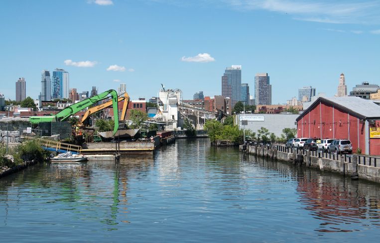
The Department of City Planning finally released a plan to rezone Gowanus, Brooklyn today, after six years of community meetings and debate.
The new land use proposal will pave the way for new development and investment on several dozen blocks around the polluted Gowanus Canal. The mix of low-slung residential and industrial properties could give way to buildings as tall as 22 stories, particularly along the canal between Bond and Nevins Streets. One publicly owned site at Smith and 5th Streets could produce a building of up to 30 stories with low-income housing, community facilities and retail, according to a press release from DCP.
The plan, which is based on a framework released last summer, would require affordable housing in all new residential projects built in the rezoned area, public waterfront access for all sites adjacent to the canal, and maintain some of the existing manufacturing zoning. It would also allow developers to build slightly taller around transit stations, in an effort to encourage denser buildings near subway stations.
Councilman Brad Lander, who has been active in the planning process for a rezoning of the area since 2013, called the proposal “a strong next step toward the sustainable, inclusive, mixed-use neighborhood that the community has been envisioning for many years. I know that not everyone is excited about the idea of new residential and commercial development at heights taller than the surrounding brownstone neighborhoods, but I genuinely believe we are on the way to getting the balance right.”
The new zoning will also extend east to Fourth Avenue, which was rezoned in 2003 under Mayor Michael Bloomberg. After 15 years of high-end residential development along the avenue, the city is imposing its Mandatory Inclusionary Housing (MIH) policy on the north-south thoroughfare in an effort to force builders to set aside at least a quarter of their units as below-market housing. New residential development will now be allowed on several blocks north and west of the canal where previously only manufacturing and commercial uses had been allowed.
Officials hope to encourage new schools, arts and nonprofit uses, and enable the cleanup of contaminated industrial properties. Landlords and developers along the canal would have to elevate their properties and implement other kinds of landscaping and drainage systems to help prevent future flooding. The plan also calls for new pedestrian bridges across the canal at 1st, President and Sackett Streets.
Lander, who represents much of the neighborhood, first kicked off the planning for the rezoning six years ago with a process called Bridging Gowanus, holding dozens of community meetings that helped produce a framework that DCP used to draft its own zoning. While neighbors initially opposed a proposal that would produce taller buildings in their low-slung and historic slice of Brooklyn, the slow-moving endeavor also irked local landlords and investors, who have been waiting to see whether they can redevelop and sell their properties.
Next, the city will hold a public meeting on the new framework on February 6 from 6 to 8 p.m. at P.S. 32, which is located at 317 Hoyt Street. It hopes to publish a draft scope of work and begin the seven-month-long land use review process this spring.
“We’ve been listening to, learning from and working with neighborhood residents, businesses, community organizations and elected officials,” said DCP Director Marisa Lago in prepared remarks. “There’s a consistent message: grow smart and grow green. Now it’s time to devise land use policies that spur job creation across a broad array of sectors; that create and preserve housing, including permanently affordable housing; and that provide new open space as the canal is cleaned up.”


