Municipal Art Society Launches Development Rights Map
By Tobias Salinger July 3, 2014 2:27 pm
reprints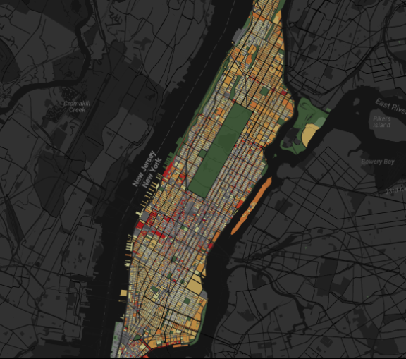

The Municipal Art Society, a longtime city planning and preservation advocacy group, launched an interactive map that allows New Yorkers to see what sites in any of the city’s neighborhoods can take on extra square footage over their existing footprints, the organization announced last week.
The nonprofit marshaled the Department of City Planning’s MapPLUTO tax lot data into a color-coded, building-by-building map with overlays for parks, historic districts and subway lines.
“New Yorkers should have a voice in major development decisions that will impact their neighborhoods,” said Margaret Newman, executive director of the nonprofit, in a prepared statement. “Too often, these decisions happen behind closed doors and most residents only hear about them once the deal is done. These maps are a step toward demystifying the city development process and bringing the public into that conversation from the start.”
A look around Manhattan on the nifty web tool, entitled “Accidental Skyline,” shows sizeable red blots with millions of square feet of untapped space under current zoning rules, especially in the area around Madison Square Garden and the space slated for Hudson Yards.
The map follows the organization’s December 2013 report by the same name that decries the shadow impact of the towers rising adjacent to Central Park on 57th Street and calls for height restrictions near parks and greater public scrutiny of zoning lot mergers.